| diagram | 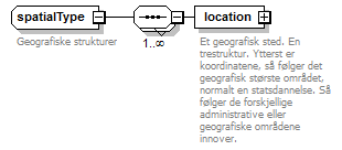 |
||||
| namespace | http://gluon.nrk.no/gluon3_1 | ||||
| children | location | ||||
| used by |
|
||||
| annotation |
|
||||
| source | <xs:complexType name="spatialType"> <xs:annotation> <xs:documentation xml:lang="nb">Geografiske strukturer</xs:documentation> <xs:documentation xml:lang="en">Describes geographical information.</xs:documentation> </xs:annotation> <xs:sequence maxOccurs="unbounded"> <xs:element name="location" type="locationType"> <xs:annotation> <xs:documentation xml:lang="nb">Et geografisk sted. En trestruktur. Ytterst er koordinatene, så følger det geografisk største området, normalt en statsdannelse. Så følger de forskjellige administrative eller geografiske områdene innover.</xs:documentation> </xs:annotation> </xs:element> </xs:sequence> </xs:complexType> |
element spatialType/location
| diagram | 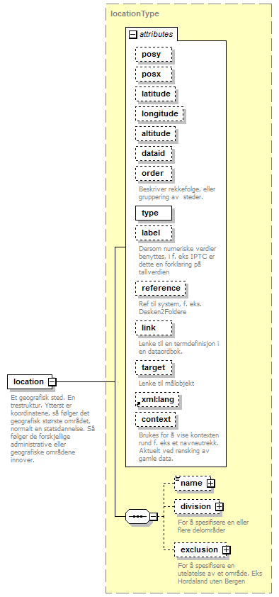 |
||||||||||||||||||||||||||||||||||||||||||||||||||||||||||||||||||||||||||||||||||||||||||||||||||||||||||
| namespace | http://gluon.nrk.no/gluon3_1 | ||||||||||||||||||||||||||||||||||||||||||||||||||||||||||||||||||||||||||||||||||||||||||||||||||||||||||
| type | locationType | ||||||||||||||||||||||||||||||||||||||||||||||||||||||||||||||||||||||||||||||||||||||||||||||||||||||||||
| properties |
|
||||||||||||||||||||||||||||||||||||||||||||||||||||||||||||||||||||||||||||||||||||||||||||||||||||||||||
| children | name division exclusion | ||||||||||||||||||||||||||||||||||||||||||||||||||||||||||||||||||||||||||||||||||||||||||||||||||||||||||
| attributes |
|
||||||||||||||||||||||||||||||||||||||||||||||||||||||||||||||||||||||||||||||||||||||||||||||||||||||||||
| annotation |
|
||||||||||||||||||||||||||||||||||||||||||||||||||||||||||||||||||||||||||||||||||||||||||||||||||||||||||
| source | <xs:element name="location" type="locationType"> <xs:annotation> <xs:documentation xml:lang="nb">Et geografisk sted. En trestruktur. Ytterst er koordinatene, så følger det geografisk største området, normalt en statsdannelse. Så følger de forskjellige administrative eller geografiske områdene innover.</xs:documentation> </xs:annotation> </xs:element> |
XML Schema documentation generated by XMLSpy Schema Editor http://www.altova.com/xmlspy