| diagram |
 |
| namespace |
http://gluon.nrk.no/gluon2 |
| type |
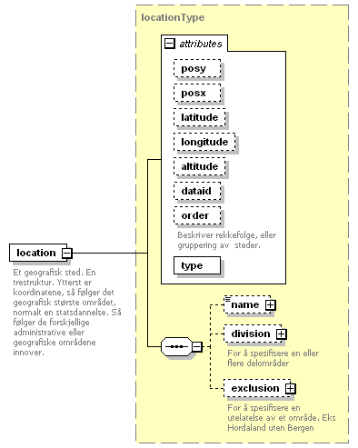
locationType |
| properties |
|
| children |
name division exclusion |
| attributes |
| Name | Type | Use | Default | Fixed | Annotation | | posy | xs:decimal | optional | | | | | posx | xs:decimal | optional | | | | | latitude | xs:decimal | optional | | | | | longitude | xs:decimal | optional | | | | | altitude | xs:decimal | optional | | | | | dataid | xs:string | optional | | | | | order | xs:int | | | | | documentation | | Beskriver rekkefolge, eller gruppering av steder. |
| | type | derived by: xs:string | required | | | |
|
| annotation |
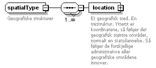
| documentation | | Et geografisk sted. En trestruktur. Ytterst er koordinatene, så følger det geografisk største området, normalt en statsdannelse. Så følger de forskjellige administrative eller geografiske områdene innover. |
|