| diagram | 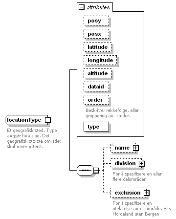 |
||||||||||||||||||||||||||||||||||||||||||||||||||||||||
| namespace | http://gluon.nrk.no/gluon3 | ||||||||||||||||||||||||||||||||||||||||||||||||||||||||
| children | name division exclusion | ||||||||||||||||||||||||||||||||||||||||||||||||||||||||
| used by |
|
||||||||||||||||||||||||||||||||||||||||||||||||||||||||
| attributes |
|
||||||||||||||||||||||||||||||||||||||||||||||||||||||||
| annotation |
|
attribute locationType/@posy
| type | xs:decimal | ||
| properties |
|
attribute locationType/@posx
| type | xs:decimal | ||
| properties |
|
attribute locationType/@latitude
| type | xs:decimal | ||
| properties |
|
attribute locationType/@longitude
| type | xs:decimal | ||
| properties |
|
attribute locationType/@altitude
| type | xs:decimal | ||
| properties |
|
attribute locationType/@dataid
| type | xs:string | ||
| properties |
|
attribute locationType/@order
| type | xs:int | ||
| annotation |
|
attribute locationType/@type
| type | restriction of xs:string | ||||||||||||||||||||||||||||||||||||||||||||||||||
| properties |
|
||||||||||||||||||||||||||||||||||||||||||||||||||
| facets |
|
element locationType/name
| diagram | 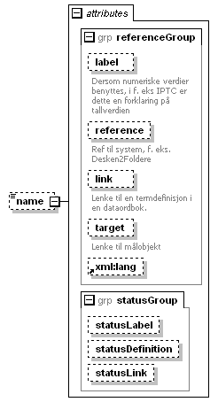 |
||||||||||||||||||||||||||||||||||||||||||||||||||||||||||||||||||
| namespace | http://gluon.nrk.no/gluon3 | ||||||||||||||||||||||||||||||||||||||||||||||||||||||||||||||||||
| type | extension of xs:string | ||||||||||||||||||||||||||||||||||||||||||||||||||||||||||||||||||
| properties |
|
||||||||||||||||||||||||||||||||||||||||||||||||||||||||||||||||||
| attributes |
|
element locationType/division
| diagram | 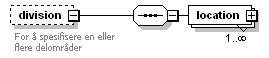 |
||||||
| namespace | http://gluon.nrk.no/gluon3 | ||||||
| properties |
|
||||||
| children | location | ||||||
| annotation |
|
element locationType/division/location
| diagram | 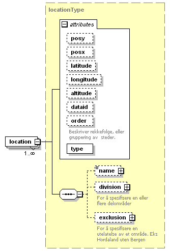 |
||||||||||||||||||||||||||||||||||||||||||||||||||||||||
| namespace | http://gluon.nrk.no/gluon3 | ||||||||||||||||||||||||||||||||||||||||||||||||||||||||
| type | locationType | ||||||||||||||||||||||||||||||||||||||||||||||||||||||||
| properties |
|
||||||||||||||||||||||||||||||||||||||||||||||||||||||||
| children | name division exclusion | ||||||||||||||||||||||||||||||||||||||||||||||||||||||||
| attributes |
|
element locationType/exclusion
| diagram | 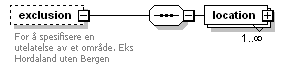 |
||||||
| namespace | http://gluon.nrk.no/gluon3 | ||||||
| properties |
|
||||||
| children | location | ||||||
| annotation |
|
element locationType/exclusion/location
| diagram |  |
||||||||||||||||||||||||||||||||||||||||||||||||||||||||
| namespace | http://gluon.nrk.no/gluon3 | ||||||||||||||||||||||||||||||||||||||||||||||||||||||||
| type | locationType | ||||||||||||||||||||||||||||||||||||||||||||||||||||||||
| properties |
|
||||||||||||||||||||||||||||||||||||||||||||||||||||||||
| children | name division exclusion | ||||||||||||||||||||||||||||||||||||||||||||||||||||||||
| attributes |
|
XML Schema documentation generated by XMLSpy Schema Editor http://www.altova.com/xmlspy